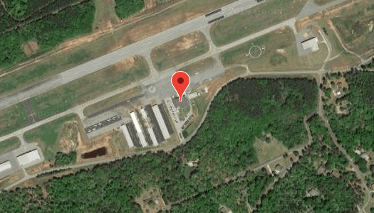
Airport Information
Runway Information:
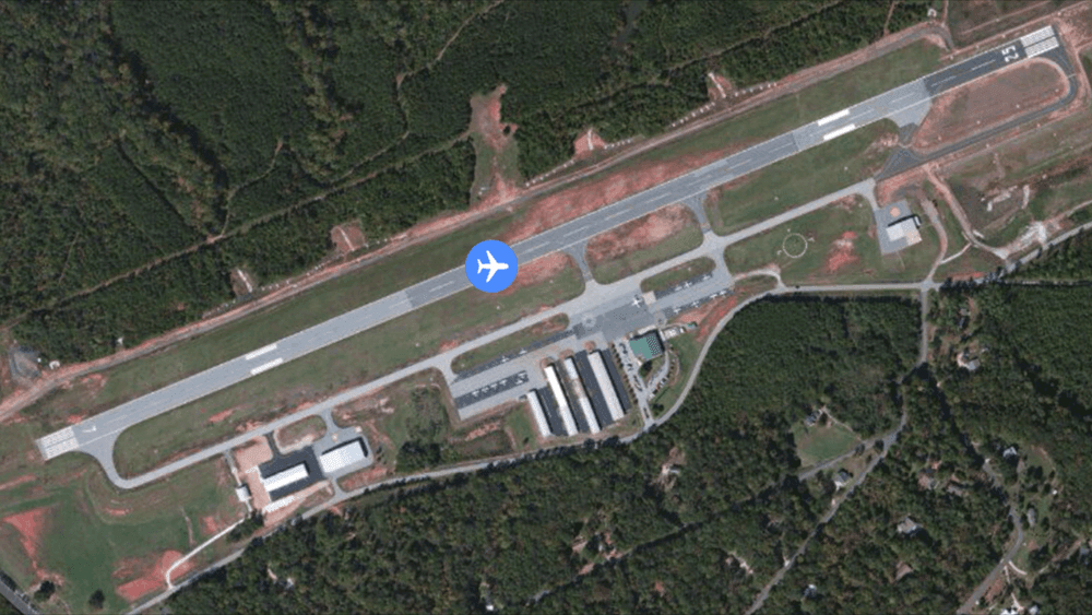 |
Dimensions: | 5000 x 100 ft. / 1524 x 30 m | |
| Surface: | asphalt, in good condition | ||
| Weight bearing capacity: | PCN 10 /F/C/Y/T Single wheel: 28.5 Double Wheel: 44.0 |
||
| Runway edge lights: | medium intensity | ||
| RUNWAY 7 | RUNWAY 25 | |
| Latitude: | 34-40.177680N | 34-40.489537N |
| Longitude: | 082-53.615565W | 082-52.692022W |
| Elevation: | 888.1 ft. | 874.4 ft. |
| Gradient: | 0.4% | 0.3% UP |
| Traffic pattern: | right | left |
| Runway headings: | 073 magnetic, 068 true | 253 magnetic, 248 true |
| Markings: | nonprecision, in good condition | nonprecision, in good condition |
| Visual slope indicator: | 2-light PAPI on left (3.00 degrees glide path) | 2-light PAPI on left (3.00 degrees glide path) |
| Runway end identifier lights: | yes | yes |
| Touchdown point: | yes, no lights | yes, no lights |
| Obstructions: | 39 ft. pine, 502 ft. from runway, 377 ft. left of centerline, 7:1 slope to clear | 28 ft. tree, 829 ft. from runway, 423 ft. right of centerline, 22:1 slope to clear |
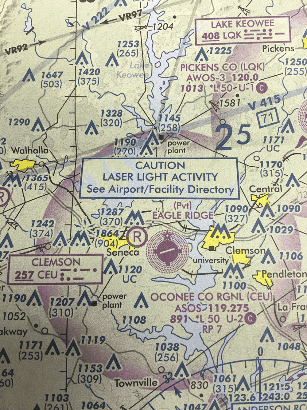
Airport Communications:
| CTAF/UNICOM: | 122.7 |
| WX ASOS: | 119.275 (864-882-0144) |
| GREER APPROACH: | 118.8 |
| GREER DEPARTURE: | 118.8 |
| WX AWOS-3 at LQK (12 nm NE): | 120.0 (864-843-0144) |
| WX ASOS at AND (14 nm SE): | 120.675 (864-226-9522) |
Nearby Radio Navigation Aids:
| VOR radial/distance | VOR name | Freq | Var |
| ELWr342/16.0 | ELECTRICTY CITY VORTAC | 108.60 | 00E |
| ODFr094/20.4 | FOOTHILLS VORTAC | 113.40 | 00E |
- APCH/DEP SVC PRVDD BY ATLANTA ARTCC ON FREQS 134.8/379.95 (MOUNT OGLETHORPE RCAG) WHEN APCH CTL CLSD